Geographical Indications of India
A geographical indication (GI) is a name or sign used on products which corresponds to
a specific geographical location or origin (e.g. a town, region, or country).
The use of a geographical indication may act as a certification that the product possesses certain qualities,
is made according to traditional methods, or enjoys a certain reputation, due to its geographical origin.
Governments have been protecting trade names and trademarks used in relation to food products identified with
a particular region since at least the end of the nineteenth century, using laws against false trade descriptions
or passing off, which generally protect against suggestions that a product has a certain origin, quality or association
when it does not. In such cases, the limitation on competitive freedoms which results from the grant of a monopoly of use
over a geographical indication is justified by governments either by consumer protection benefits or by producer protection benefits.

Jammu And Kashmir

is a state in northern India, often denoted by the acronym J&K.
It is located mostly in the Himalayan mountains, and shares borders with the states of Himachal
Pradesh and Punjab to the south. Jammu and Kashmir has an international border with China in the north and east,
and the Line of Control separates it from the Pakistani-administered territories of Azad Kashmir and Gilgit-Baltistan in the west and northwest respectively.
The state has special autonomy under Article 370 of the Constitution of India.
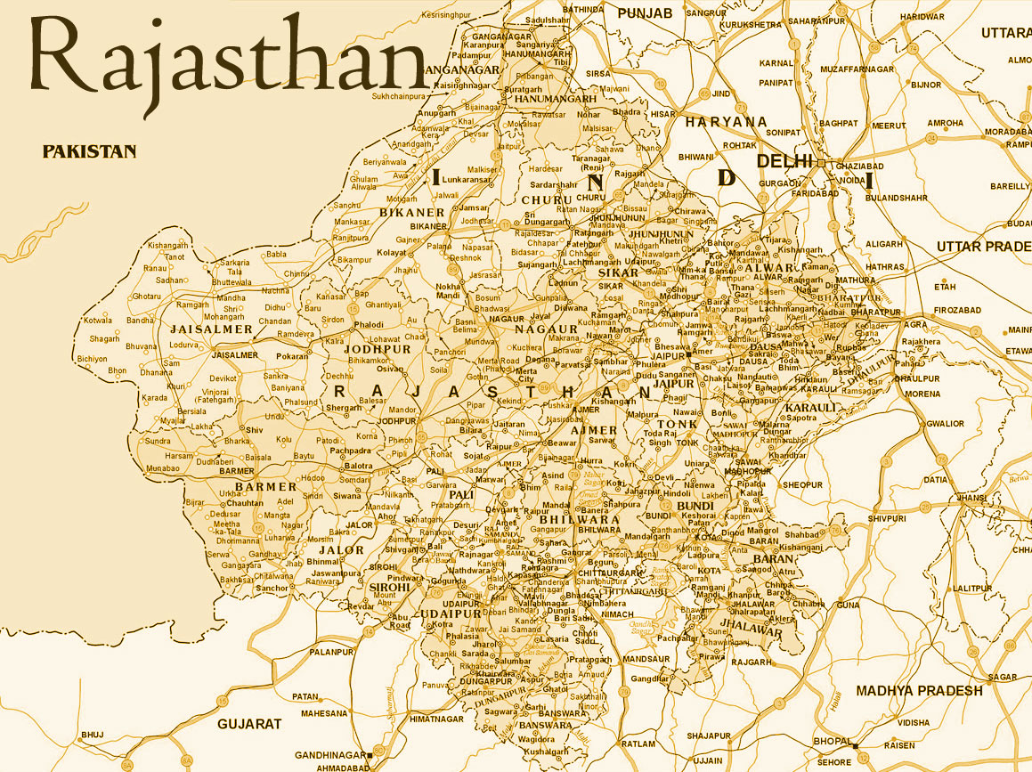
Rajasthan

is a state in northern India, often denoted by the acronym J&K.
It is located mostly in the Himalayan mountains, and shares borders with the states of Himachal
Pradesh and Punjab to the south. Jammu and Kashmir has an international border with China in the north and east,
and the Line of Control separates it from the Pakistani-administered territories of Azad Kashmir and Gilgit-Baltistan in the west and northwest respectively.
The state has special autonomy under Article 370 of the Constitution of India.
Major features include the ruins of the Indus Valley Civilisation at Kalibanga; the Dilwara Temples, a Jain pilgrimage site at Rajasthan's only hill station, Mount Abu, in the ancient Aravalli mountain range; and, in eastern Rajasthan, the Keoladeo National Park near Bharatpur, a World Heritage Site[6] known for its bird life. Rajasthan is also home to three national tiger reserves, the Ranthambore National Park in Sawai Madhopur,
Sariska Tiger Reserve in Alwar and Mukundra Hill Tiger Reserve in Kota.
Darjeeling

Darjeeling is a town and a municipality in the Indian state of West Bengal.
It is located in the Lesser Himalayas at an elevation of 6,700 ft (2,042.2 m).
It is noted for its tea industry, its spectacular views of the Kangchenjunga, the
world's third-highest mountain, and the Darjeeling Himalayan Railway, a UNESCO World
Heritage Site. Darjeeling is the headquarters of the Darjeeling District which has a
partially autonomous status within the state of West Bengal. It is also a popular tourist destination in India.
The recorded history of the town starts from the early 19th century when the colonial a
dministration under the British Raj set up a sanatorium and a military depot in the region.
Subsequently, extensive tea plantations were established in the region and tea growers
developed hybrids of black tea and created new fermentation techniques. The resultant
distinctive Darjeeling tea is internationally recognised and ranks among the most popular black teas in the world.[3]
The Darjeeling Himalayan Railway connects the town with the plains and has some of the
few steam locomotives still in service in India.
Darjeeling has several British-style public schools, which attract pupils from all over
India and a few neighbouring countries. The varied culture of the town reflects its diverse
demographic milieu comprising indigenous Bengali, Nepali, Lepchas, Bhutia, Tibetans, and other
mainland Indian ethno-linguistic groups. Darjeeling, alongside its neighbouring town of Kalimpong,
was the centre of the Gorkhaland movement in the 1980s. The town's fragile ecology has been threatened by
a rising demand for environmental resources, stemming from growing tourist traffic and poorly planned urbanisation.
Kerala

Kerala (/ˈkɛrələ/), historically known as Keralam, is an Indian state in South India on the Malabar Coast.
It was formed on 1 November 1956 following the States Reorganisation Act by combining Malayalam-speaking regions.
Spread over 38,863 km2 (15,005 sq mi), it is bordered by Karnataka to the north and northeast, Tamil Nadu to the east and south,
and the Lakshadweep Sea to the west. With 33,387,677 inhabitants as per the 2011 Census, Kerala is the thirteenth-largest Indian
state by population. It is divided into 14 districts with the capital and the largest city being Thiruvananthapuram.
Malayalam is the most widely spoken language and is also the official language of the state.
Madhya Pradesh

Madhya Pradesh[5] (MP) (/ˈmɑːdjə prəˈdɛʃ/, About this sound (help·info), meaning Central Province) is a
state in central India. Its capital is Bhopal and the largest city is Indore with Gwalior and Jabalpur being the
other major cities. Nicknamed the "heart of India" due to its geographical location in India, Madhya Pradesh is the
second-largest state in the country by area. With over 75 million inhabitants, it is the fifth-largest state in India by
population. It borders the states of Uttar Pradesh to the northeast, Chhattisgarh to the southeast, Maharashtra to the south,
Gujarat to the west, and Rajasthan to the northwest. Its total area is 308,252 km2. Before 2000, when Chhattisgarh was a part of
Madhya Pradesh, Madhya Pradesh was the largest state in India and the distance between the two
furthest points inside the state, Singoli and Konta, was 1500 km.
Maharashtra

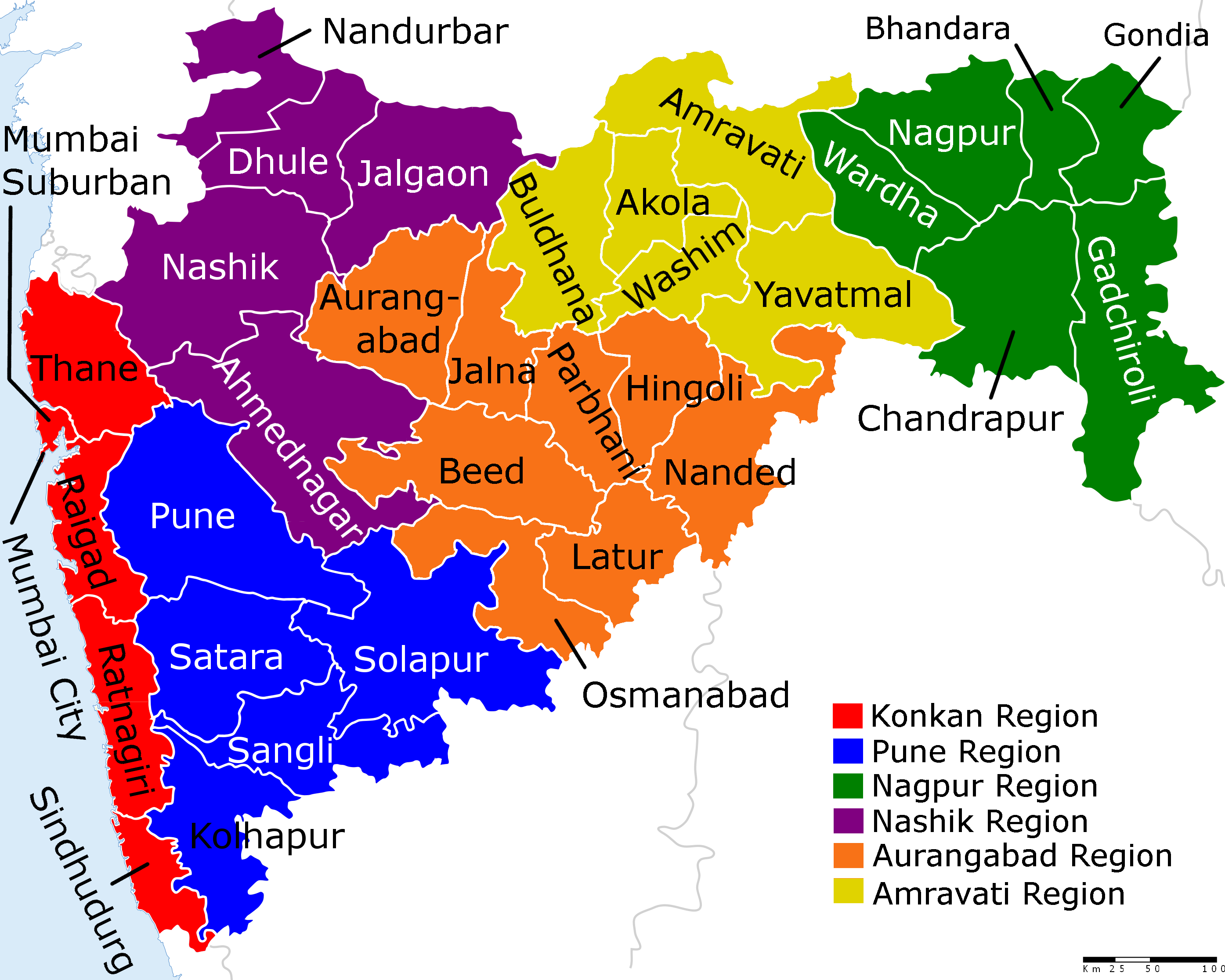
Maharashtra is the wealthiest state by GDP and also the most industrialized state in India. It is one of the most developed states in India, contributing 25% of the country's industrial output and 23.2% of its GDP (2010–11).[8] As of 2011, the state had a per capita income of ₹1.0035 lakh (US$1,600), more than the national average of ₹0.73 lakh (US$1,100). Its GDP per capita crossed the ₹1.20 lakh (US$1,900) threshold for the first time in 2013, making it one of the richest states in India. However, as of 2014, the GDP per capita reduced to ₹1.03 lakh (US$1,600).[9]
Mumbai is the capital of Maharashtra since the day it was formed.The major rivers of the state are Godavari, and Krishna. The Narmada and Tapti Rivers flow near the border between Maharashtra and Madhya Pradesh and Gujarat. Maharashtra is the third most urbanised state among major states in India.[10][11] Ancient and medieval Maharashtra was ruled by the Satavahana dynasty, Rashtrakuta dynasty, Western Chalukyas, Deccan sultanates, Mughals and Marathas respectively. Ruins, monuments, tombs, forts and places of worship left by these rulers are dotted around the state. They include the world heritage sites of Ajanta caves and Ellora caves. There are also numerous forts associated with the life of Shivaji Maharaj.


